 RoadTrp.org | 2026 2024 2019 2018 2017 2016 2014 2013 2011 2010 2009 | parks maps trips | faq search
| RoadTrp.org | 2026 2024 2019 2018 2017 2016 2014 2013 2011 2010 2009 | parks maps trips | faq search |
| VLA/Pie Town: | [Day 1] | Tue May 10 | Drive day | Drive day · 7 videos |
| [Day 2] | Wed May 11 | The Very Large Array and Pie Town, NM; on to Grand Canyon Village | The Very Large Array and Pie Town, NM; on to Grand Canyon Village · 38 videos | |
| Grand Canyon N.P. (South Rim): | [Day 3] | Thu May 12 | Grand Canyon South Rim | Grand Canyon South Rim · 16 videos |
| [Day 4] | Fri May 13 | South Kaibab hike | South Kaibab hike · 22 videos | |
| [Day 5] | Sat May 14 | Bright Angel hike to Indian Garden | Bright Angel hike to Indian Garden · 13 videos | |
| Grand Canyon N.P. (North Rim): | [Day 6] | Sun May 15 | To the North Rim; Bright Angel Point | To the North Rim; Bright Angel Point · 27 videos |
| [Day 7] | Mon May 16 | North Rim: Walhalla Plateau | North Rim: Walhalla Plateau · 27 videos | |
| Zion N.P.: | [Day 8] | Tue May 17 | To Zion; Observation Point hike | To Zion; Observation Point hike · 19 videos |
| [Day 9] | Wed May 18 | The Narrows | The Narrows · 12 videos | |
| [Day 10] | Thu May 19 | Angels Landing and Kolob Canyons | Angels Landing and Kolob Canyons · 21 videos | |
| Great Basin N.P.: | [Day 11] | Fri May 20 | To Great Basin National Park; Lehman Caves | To Great Basin National Park; Lehman Caves · 14 videos |
| [Day 12] | Sat May 21 | Bonneville Salt Flats and Great Basin | Bonneville Salt Flats and Great Basin · 9 videos | |
| Zion N.P. (II): | [Day 13] | Sun May 22 | Second visit to Zion, then on toward Bryce Canyon | Second visit to Zion, then on toward Bryce Canyon · 25 videos |
| Bryce Canyon N.P.: | [Day 14] | Mon May 23 | Bryce Canyon National Park | Bryce Canyon National Park · 29 videos |
| Arches N.P.: | [Day 15] | Tue May 24 | To Arches via Capitol Reef | To Arches via Capitol Reef · 22 videos |
| [Day 16] | Wed May 25 | Devils Garden and Delicate Arch | Devils Garden and Delicate Arch · 14 videos | |
| [Day 17] | Thu May 26 | Fiery Furnace and Dead Horse Point | Fiery Furnace and Dead Horse Point · 8 videos | |
| Canyonlands N.P.: | [Day 18] | Fri May 27 | Canyonlands: Island in the Sky and the Needles | Canyonlands: Island in the Sky and the Needles · 22 videos |
| Monument Valley/Mesa Verde N.P.: | [Day 19] | Sat May 28 | Monument Valley and Mesa Verde | Monument Valley and Mesa Verde · 16 videos |
| Great Sand Dunes N.P.: | [Day 20] | Sun May 29 | Great Sand Dunes: Star Dune hike | Great Sand Dunes: Star Dune hike · 11 videos |
| [Day 21/22] | Mon May 30 | Great Sand Dunes backup day, then the drive east | Great Sand Dunes backup day, then the drive east · 4 videos | |
| Route Map: | [Route][all maps] | |||
| Day's Summary: To the North Rim; Bright Angel Point. Overnight: North Rim Campground. |

Heading to the North Rim from the South Rim.

East Rim Drive runs from Grand Canyon Village in the west (what I refer to as the "South Rim," even though East Rim Drive is technically along the South Rim) to Desert View in the east. There are five overlooks that are part of East Rim Drive: 1) Yaki Point, 2) Grandview Point, 3) Moran Point, and 4) Lipan Point. Since Yaki Point is so near Grand Canyon Village, and the buses run to Yaki Point, I usually don't consider it an East Rim Drive overlook, but strictly speaking, it is.

Some signage and people at Grandview.

"Grand view" is an understatement, don't you think?

Another grand view at Grandview. If you notice the previous video, there's a rock outcropping directly in front of where I'm filming. That's where I stood to take this video. Not especially precarious, although watch that step, it's a lulu!

(No, it's not pronounced "moron.") Another fantastic vista along East Rim Drive.

Close-up of the Colorado River. Very windy.

Another "run-of-the-mill" breathtaking view into the Grand Canyon.
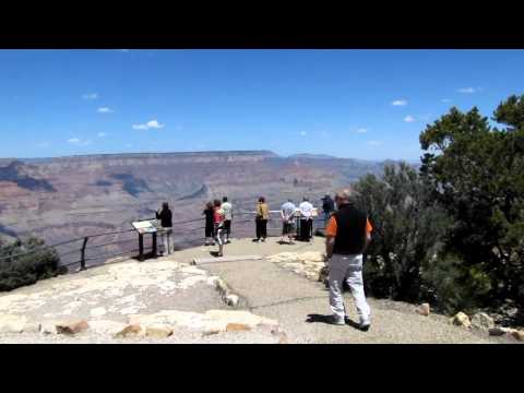
Views of the parking lot, the canopied sign, and the overlook itself.
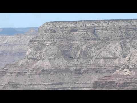
Zoom-in on a helicopter, ostensibly giving a tour. Perhaps from Vegas?

I perform a 360-degree turn to show the parking lot, canopied sign, and the overlook.

Leaving Lipan Point. I note in the video that the East Rim Drive views are just as spectacular (if not more so) than the South Rim views at Grand Canyon Village.

Watchtower in the distance (further east) that is accessible from Desert View.

Views from Navajo Point.

Zoom-in to the Watchtower.

Ascending the three flights of stairs of the Watchtower. 'Scuse me!

View of the observation area of the Watchtower, as well as some of the views back towards Desert View. At 0:40, a view towards the roof of the Watchtower. Too bad you can't go up there.

View of the Canyon through the windows of the observation area of the Watchtower.

Descending the three flights of stairs of the Watchtower. Hurry it up!

After Desert View, cruising towards the North Rim in the RAV4 along one of the most beautiful routes in the country, US 89A.

My camera does have a wind filter, and perhaps I should have used it. I like hearing how windy it was, though.

Okay, I'm not acrophobic, but like most people there are certain things that can unnerve me. This Navajo Bridge did. I didn't even really know this cool bridge was going to be here. Obviously, I knew that the Colorado River had to be crossed, but I didn't know it would be so amazing.
I drove across the bridge coming from the southeast and noticed there was a visitor's center, so I decided to take a quick stop. I'm glad I did. I walked on the original "Navajo Bridge" that is pedestrian accessible (built in 1929); the new one (built 1994) is used for traffic. Even though I was a tad reticent, I enjoyed the view of the river below.
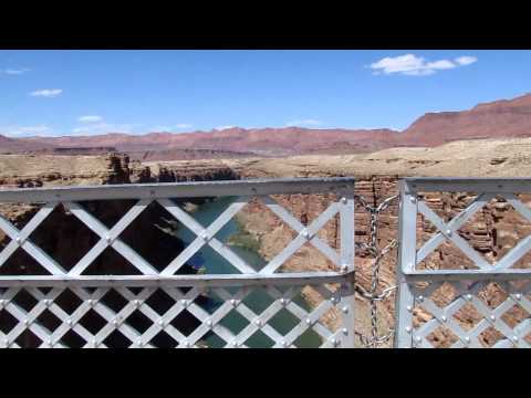
At the center of the bridge. 0:50, you can see the shadow (not "reflection") of the bridge. Dizzying panorama at the end.
I think this is a good place to bungee jump. (No thanks.)

View from a pulloff along the ascent towards Jacob Lake, the gateway to the North Rim.

Walking from the North Rim Campground to the Grand Canyon Lodge (food, basically) via the Transept Trail. Extremely windy and colder. The North Rim is 2000ft (approximately 600m) higher in elevation than the South Rim.

Near the Grand Canyon Lodge.

Hiking back via the Transept Trail from the Grand Canyon Lodge to the North Rim Campground.