 RoadTrp.org | 2026 2024 2019 2018 2017 2016 2014 2013 2011 2010 2009 | parks maps trips | faq search
| RoadTrp.org | 2026 2024 2019 2018 2017 2016 2014 2013 2011 2010 2009 | parks maps trips | faq search |
| VLA/Pie Town: | [Day 1] | Tue May 10 | Drive day | Drive day · 7 videos |
| [Day 2] | Wed May 11 | The Very Large Array and Pie Town, NM; on to Grand Canyon Village | The Very Large Array and Pie Town, NM; on to Grand Canyon Village · 38 videos | |
| Grand Canyon N.P. (South Rim): | [Day 3] | Thu May 12 | Grand Canyon South Rim | Grand Canyon South Rim · 16 videos |
| [Day 4] | Fri May 13 | South Kaibab hike | South Kaibab hike · 22 videos | |
| [Day 5] | Sat May 14 | Bright Angel hike to Indian Garden | Bright Angel hike to Indian Garden · 13 videos | |
| Grand Canyon N.P. (North Rim): | [Day 6] | Sun May 15 | To the North Rim; Bright Angel Point | To the North Rim; Bright Angel Point · 27 videos |
| [Day 7] | Mon May 16 | North Rim: Walhalla Plateau | North Rim: Walhalla Plateau · 27 videos | |
| Zion N.P.: | [Day 8] | Tue May 17 | To Zion; Observation Point hike | To Zion; Observation Point hike · 19 videos |
| [Day 9] | Wed May 18 | The Narrows | The Narrows · 12 videos | |
| [Day 10] | Thu May 19 | Angels Landing and Kolob Canyons | Angels Landing and Kolob Canyons · 21 videos | |
| Great Basin N.P.: | [Day 11] | Fri May 20 | To Great Basin National Park; Lehman Caves | To Great Basin National Park; Lehman Caves · 14 videos |
| [Day 12] | Sat May 21 | Bonneville Salt Flats and Great Basin | Bonneville Salt Flats and Great Basin · 9 videos | |
| Zion N.P. (II): | [Day 13] | Sun May 22 | Second visit to Zion, then on toward Bryce Canyon | Second visit to Zion, then on toward Bryce Canyon · 25 videos |
| Bryce Canyon N.P.: | [Day 14] | Mon May 23 | Bryce Canyon National Park | Bryce Canyon National Park · 29 videos |
| Arches N.P.: | [Day 15] | Tue May 24 | To Arches via Capitol Reef | To Arches via Capitol Reef · 22 videos |
| [Day 16] | Wed May 25 | Devils Garden and Delicate Arch | Devils Garden and Delicate Arch · 14 videos | |
| [Day 17] | Thu May 26 | Fiery Furnace and Dead Horse Point | Fiery Furnace and Dead Horse Point · 8 videos | |
| Canyonlands N.P.: | [Day 18] | Fri May 27 | Canyonlands: Island in the Sky and the Needles | Canyonlands: Island in the Sky and the Needles · 22 videos |
| Monument Valley/Mesa Verde N.P.: | [Day 19] | Sat May 28 | Monument Valley and Mesa Verde | Monument Valley and Mesa Verde · 16 videos |
| Great Sand Dunes N.P.: | [Day 20] | Sun May 29 | Great Sand Dunes: Star Dune hike | Great Sand Dunes: Star Dune hike · 11 videos |
| [Day 21/22] | Mon May 30 | Great Sand Dunes backup day, then the drive east | Great Sand Dunes backup day, then the drive east · 4 videos | |
| Route Map: | [Route][all maps] | |||
| Day's Summary: North Rim: Walhalla Plateau. Overnight: Quail Park Lodge, Kanab. |

As you can see, I had spot #25 at the North Rim Campground. Cold, windy, and not as many people around. I believe I actually was camping on either the first or second night the North Rim was open. It opens "mid-May," which seems to be somewhat non-specific.
I take it to be May 15th, which was the case in 2011. In addition, May 15th was a Sunday, so that leads me to believe it's May 15th every year, regardless of day of the week.

After leaving the campsite, I had a great breakfast at the Grand Canyon Lodge North Rim. Number one, there was a fantastic view of the Canyon from the dining room. I'd strongly recommend breakfast since I think it's less crowded than dinner. Remember, though the North Rim has fewer accommodations, it also has only 10% of the total visitors of the Grand Canyon. Anyway, the view was great and there weren't many people dining in the morning. Now, I'm sure the Breakfast Buffet is great, but I got the Widfross Huevos Rancheros. I know don't have as refined tastes as some, but I was surprised at how good it was. Perhaps basking in the ambience of the Canyon led me to enjoy my dining even more? I'm not sure.
This video shows a view from the "back porch" of the Grand Canyon Lodge North Rim. At 0:15, I believe this is the across-the-Canyon South Kaibab Trail I'm zooming in on as it Trail (on the left of the video) circles around O'Neill Butte.
At 0:45, I pan around to show a panorama as well as large windows that are looking out from the dining room.

Along the Transept Trail, I pan around to the Lodge as well as an overlook.

Walking to an overlook (I'll call #1) near the back porch of the North Rim Lodge. It goes without saying, but...what a view! The video really can't capture the entire grandeur of it. At around 1:00, I pan to a view of the Lodge.

Overlook #2 is a little bit further away from the Lodge near the southern terminus of the Transept Trail, near the beginning of the Bright Angel Point Trail.
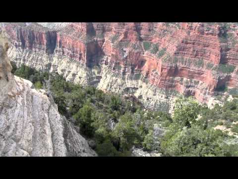
From overlook #2, I first pan around to see overlook #1. Then, I zoom cross-canyon to see the South Rim. Again, what a great view!

Apparently the Bright Angel Point Trail begins either at the east patio of the Lodge or the parking lot for the Lodge. So, there's essentially two trailheads. I'm walking the non-paved/somewhat paved part that starts at the east patio (near the overlooks) of the Lodge and then connects to the paved part at around 1:00 into the video.

Near Bright Angel Point. Taking in the vastness and grandeur of the locale.

The sign at the beginning of the video gives an excellent description of what you're looking at from Bright Angel Point. I perform a rough 360-degree pan around 0:30. Bright Angel Fault sign at 0:45.

The North Rim seemed so much more relaxed than the South Rim. I thoroughly enjoyed it, including the area around the Visitor's Center.

A 360-degree pan of the area around the North Rim Visitor's Center sign, including the cabins.

Cape Royal Road begins when it branches east from the North Rim Entrance Road (that comes from Jacob Lake). Most of the road extends south through the Walhalla Plateau, a large isthmus of rock jutting into the Grand Canyon. Vista Encantada is one of the first major stops/overlooks, meaning it is one of the northernmost overlooks on the Walhalla Plateau.

A 360-degree pan at Vista Encantada. I'm not on the very edge, because that'd be stupid.

As mentioned in the video, I'm walking along the Roosevelt Point Trail. Contains stunning views.

Walking along the Roosevelt Point Trail. There was apparently a fire in the year 2000 called the Outlook Fire, and you can see some charred tree remnants associated with that fire.
Whoops! Almost faceplanted at around 1:53. Geologic marker at the very end of the video.

Better view of the geologic marker, dated 1903. Very windy. Very beautiful. Very prickly. Very cold.

Despite what is said at the very beginning of the video, this isn't really Cape Royal. It's closeby, but this is showing Angel's Window, a natural arch which does refer to the hole in the rock. I like the transition between this video and the next. The next one is a little, er, unsettling.

Walking out onto the Angel's Window rock outcropping is a little scary, as I mention. Very windy. As far as I can tell, the thin walkway is where the "Angel's Window" arch/hole is located.
Just like other places in my travels, the video doesn't really do the "unsettling feeling" justice. As I say in the video, I'm not really acrophobic, but I believe I do have a healthy fear of heights (as all people probably should).
The wind settles down for a bit at 1:00 or so, and for a while I'm the only person on the rock outcropping! Good Colorado River view at 2:05. San Francisco Peaks at 2:25.

A view into the Canyon from Cape Royal. Looking approximately south and slightly west.

A view towards the distant South Rim Canyon edge from Cape Royal. Looking approximately south and slightly east towards the general area between Moran and Lipan Point.

I was going to perform a 360-degree pan, but I pressed the record button twice perhaps? Go to the next video for the actual pan...

I perform a 360-degree pan with the camera.

Point Imperial Road branches towards the northeast around 5 miles from the beginning of Cape Royal Road. Point Imperial is at the end of Point Imperial Road, appropriately.
This view is roughly east towards Tuba City, AZ.

A (windy) pan that gives some view of the overlook itself.

Subalpine meadow on the North Rim Entrance Road. As I mention in the video, it reminds me of Tuolumne in Yosemite National Park.

Yelling is fun...

Here's a tip for people who enjoy taking video and pictures on your road trips: try to include mile markers. That way, if you forget exactly where you were, the mile marker can help identify it. Trust me, on a long road trip, you're gonna forget a lot of things that you--at the time--think you'll definitely remember.
On this video, I'm at mile marker 597 along US 89A north to Kanab, UT.