 RoadTrp.org | 2026 2024 2019 2018 2017 2016 2014 2013 2011 2010 2009 | parks maps trips | faq search
| RoadTrp.org | 2026 2024 2019 2018 2017 2016 2014 2013 2011 2010 2009 | parks maps trips | faq search |
| VLA/Pie Town: | [Day 1] | Tue May 10 | Drive day | Drive day · 7 videos |
| [Day 2] | Wed May 11 | The Very Large Array and Pie Town, NM; on to Grand Canyon Village | The Very Large Array and Pie Town, NM; on to Grand Canyon Village · 38 videos | |
| Grand Canyon N.P. (South Rim): | [Day 3] | Thu May 12 | Grand Canyon South Rim | Grand Canyon South Rim · 16 videos |
| [Day 4] | Fri May 13 | South Kaibab hike | South Kaibab hike · 22 videos | |
| [Day 5] | Sat May 14 | Bright Angel hike to Indian Garden | Bright Angel hike to Indian Garden · 13 videos | |
| Grand Canyon N.P. (North Rim): | [Day 6] | Sun May 15 | To the North Rim; Bright Angel Point | To the North Rim; Bright Angel Point · 27 videos |
| [Day 7] | Mon May 16 | North Rim: Walhalla Plateau | North Rim: Walhalla Plateau · 27 videos | |
| Zion N.P.: | [Day 8] | Tue May 17 | To Zion; Observation Point hike | To Zion; Observation Point hike · 19 videos |
| [Day 9] | Wed May 18 | The Narrows | The Narrows · 12 videos | |
| [Day 10] | Thu May 19 | Angels Landing and Kolob Canyons | Angels Landing and Kolob Canyons · 21 videos | |
| Great Basin N.P.: | [Day 11] | Fri May 20 | To Great Basin National Park; Lehman Caves | To Great Basin National Park; Lehman Caves · 14 videos |
| [Day 12] | Sat May 21 | Bonneville Salt Flats and Great Basin | Bonneville Salt Flats and Great Basin · 9 videos | |
| Zion N.P. (II): | [Day 13] | Sun May 22 | Second visit to Zion, then on toward Bryce Canyon | Second visit to Zion, then on toward Bryce Canyon · 25 videos |
| Bryce Canyon N.P.: | [Day 14] | Mon May 23 | Bryce Canyon National Park | Bryce Canyon National Park · 29 videos |
| Arches N.P.: | [Day 15] | Tue May 24 | To Arches via Capitol Reef | To Arches via Capitol Reef · 22 videos |
| [Day 16] | Wed May 25 | Devils Garden and Delicate Arch | Devils Garden and Delicate Arch · 14 videos | |
| [Day 17] | Thu May 26 | Fiery Furnace and Dead Horse Point | Fiery Furnace and Dead Horse Point · 8 videos | |
| Canyonlands N.P.: | [Day 18] | Fri May 27 | Canyonlands: Island in the Sky and the Needles | Canyonlands: Island in the Sky and the Needles · 22 videos |
| Monument Valley/Mesa Verde N.P.: | [Day 19] | Sat May 28 | Monument Valley and Mesa Verde | Monument Valley and Mesa Verde · 16 videos |
| Great Sand Dunes N.P.: | [Day 20] | Sun May 29 | Great Sand Dunes: Star Dune hike | Great Sand Dunes: Star Dune hike · 11 videos |
| [Day 21/22] | Mon May 30 | Great Sand Dunes backup day, then the drive east | Great Sand Dunes backup day, then the drive east · 4 videos | |
| Route Map: | [Route][all maps] | |||
| Day's Summary: Bryce Canyon National Park. Overnight: Bryce Canyon Inn. |

To accommodate the extra day at Zion, I clipped a day off Bryce Canyon. In retrospect, it was a great idea. Not so much because of the loss of time at Bryce Canyon, but to be able to hike Angel's Landing was well worth it.
I'm at Sunset Campground, and the plan for the day is to see some overlooks along the Bryce Canyon Scenic Drive (essentially Utah State Route 63) and go on a hike.

Now, if there's a scenic drive that you're going to drive all the way to the end and then basically do a U-turn, how do you approach that? Do you stop along the way to see the scenic points and then at the end drive all the way back? At first I thought I'd just stop along the very "best" overlooks. I ended up stopping at most of them.
This is around halfway down the Bryce Canyon Scenic Drive, and it's Farview Point. Wispy and cloudy this morning.

Snowing in Bryce Canyon. In May!

This is at the south end of Bryce Canyon Scenic Drive. Beautiful vistas and lots of hoodoos to be seen. Yovimpa Point is a short walk from here, but since I was pressed for time I didn't go.
Near the end of the video I mentioned that I might not get to hike. I was wrong.

Another view from Rainbow Point. I've moved to the north from the previous video, although I'm still at Rainbow Point (the southernmost overlook).

Good view of some hoodoos.

Ponderosa Point. Giddyup?
Crow at 0:30.

Interesting hoodoo formations.

More hoodoos.

It's a bridge, and it's natural. Go figure!

Bryce Point was one of the most beautiful places in the entire park, and the next four videos are dedicated to it. You can see the amphitheater region with all the various hoodoos and some really awesome, scenic hiking trails (in later videos). What an amazing landscape, don't you think? I start walking at 0:40.

Sometimes I wish I had better video stabilization! I'm walking north to the walkway at Bryce Point that juts out into the canyon. Perhaps the most scenic place in the park.
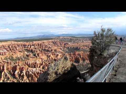
An almost-360 degree pan of the north part of Bryce Point.
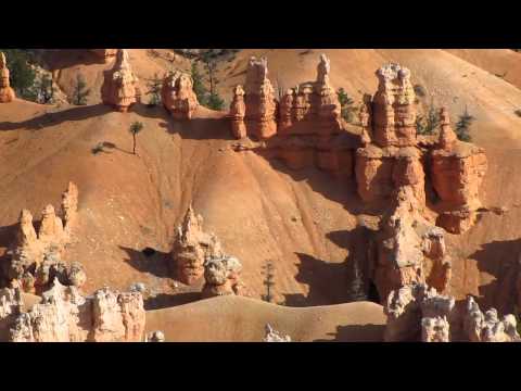
Hiking trails and hoodoos in the amphitheater.

Another very scenic overlook. At the end of the video I film Upper Inspiration Point. I said I wasn't going to walk up there, but carpe diem, right?

Some walking to Upper Inspiration Point. Again, very scenic. (Apologies for the sucking wind.)
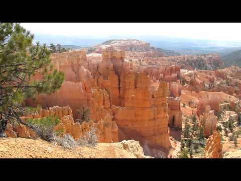
The remainder of this day's videos are from the combined Queens Garden-Navajo Loop Hike. Parking and starting at Sunrise Point, I hiked (A) 1.7 miles down via the Queens Garden Trail, then hiked (B) 0.7 miles up via the southern part of the Navajo Loop Trail to arrive at Sunset Point, then hiked (C) 0.5 miles along the Rim Trail to Sunrise Point.

Hello, hoodoo. This video shows an overview of a lot of the canyon features near the Queens Garden Trail.
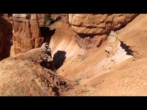
I wonder: is a red baseball cap a naturally-occurring feature of Bryce Canyon?

A bit windy in the Garden.

Great video to give you a feel of what it's like to hike along the Queens Garden Trail in the heart of Bryce Canyon.

Some hiking through a rock opening and looking at hoodoos that look vaguely like chess pieces.

I think that's a small slot canyon that I'm looking at.

I fit through, just barely. (Kidding.)

Looking up towards Sunset Point

I never felt in danger, but apparently this is a common area for rock slides and potential injury due to that. As I mention, plenty of rocks strewn around, though.

At the beginning of the video is where I was coming from previously, and then you see the zigzag switchbacks heading up towards Sunset Point. Switchbacks are always a bear, and here's why: they're there to make it easier to ascend up a steep incline. Fine, but they're STILL usually steep because you're trying to ascend an incline! So you get lots of hiking up steep grades. Better than going straight up, I guess.

Fewer switchbacks left until Sunset Point.

Nearing the top, looking down on the poor souls who aren't as high as me!