 RoadTrp.org | 2026 2024 2019 2018 2017 2016 2014 2013 2011 2010 2009 | parks maps trips | faq search
| RoadTrp.org | 2026 2024 2019 2018 2017 2016 2014 2013 2011 2010 2009 | parks maps trips | faq search |
| VLA/Pie Town: | [Day 1] | Tue May 10 | Drive day | Drive day · 7 videos |
| [Day 2] | Wed May 11 | The Very Large Array and Pie Town, NM; on to Grand Canyon Village | The Very Large Array and Pie Town, NM; on to Grand Canyon Village · 38 videos | |
| Grand Canyon N.P. (South Rim): | [Day 3] | Thu May 12 | Grand Canyon South Rim | Grand Canyon South Rim · 16 videos |
| [Day 4] | Fri May 13 | South Kaibab hike | South Kaibab hike · 22 videos | |
| [Day 5] | Sat May 14 | Bright Angel hike to Indian Garden | Bright Angel hike to Indian Garden · 13 videos | |
| Grand Canyon N.P. (North Rim): | [Day 6] | Sun May 15 | To the North Rim; Bright Angel Point | To the North Rim; Bright Angel Point · 27 videos |
| [Day 7] | Mon May 16 | North Rim: Walhalla Plateau | North Rim: Walhalla Plateau · 27 videos | |
| Zion N.P.: | [Day 8] | Tue May 17 | To Zion; Observation Point hike | To Zion; Observation Point hike · 19 videos |
| [Day 9] | Wed May 18 | The Narrows | The Narrows · 12 videos | |
| [Day 10] | Thu May 19 | Angels Landing and Kolob Canyons | Angels Landing and Kolob Canyons · 21 videos | |
| Great Basin N.P.: | [Day 11] | Fri May 20 | To Great Basin National Park; Lehman Caves | To Great Basin National Park; Lehman Caves · 14 videos |
| [Day 12] | Sat May 21 | Bonneville Salt Flats and Great Basin | Bonneville Salt Flats and Great Basin · 9 videos | |
| Zion N.P. (II): | [Day 13] | Sun May 22 | Second visit to Zion, then on toward Bryce Canyon | Second visit to Zion, then on toward Bryce Canyon · 25 videos |
| Bryce Canyon N.P.: | [Day 14] | Mon May 23 | Bryce Canyon National Park | Bryce Canyon National Park · 29 videos |
| Arches N.P.: | [Day 15] | Tue May 24 | To Arches via Capitol Reef | To Arches via Capitol Reef · 22 videos |
| [Day 16] | Wed May 25 | Devils Garden and Delicate Arch | Devils Garden and Delicate Arch · 14 videos | |
| [Day 17] | Thu May 26 | Fiery Furnace and Dead Horse Point | Fiery Furnace and Dead Horse Point · 8 videos | |
| Canyonlands N.P.: | [Day 18] | Fri May 27 | Canyonlands: Island in the Sky and the Needles | Canyonlands: Island in the Sky and the Needles · 22 videos |
| Monument Valley/Mesa Verde N.P.: | [Day 19] | Sat May 28 | Monument Valley and Mesa Verde | Monument Valley and Mesa Verde · 16 videos |
| Great Sand Dunes N.P.: | [Day 20] | Sun May 29 | Great Sand Dunes: Star Dune hike | Great Sand Dunes: Star Dune hike · 11 videos |
| [Day 21/22] | Mon May 30 | Great Sand Dunes backup day, then the drive east | Great Sand Dunes backup day, then the drive east · 4 videos | |
| Route Map: | [Route][all maps] | |||
| Day's Summary: Monument Valley and Mesa Verde. Overnight: Spruce Lodge, South Fork, CO. |

Filming in the morning. At 0:13 I zoom in to some Monument Valley buttes in the distance. From left to right in the first collection: Castle Butte (tall big chunk), Bear & Rabbit Butte (two thin parts), and Stagecoach Butte (longer). Proceeding right, King on His Throne Butte (v-shaped), and then a big butte known as Saddleback Butte. These are often the same buttes seen in the famous "Forrest Gump" picture of US-163.
At 0:32 I zoom in to film the San Juan River.

I try to get an overview of the landscape, including an almost 360 degree pan. My shadow at 0:49.

Zoom to my car-camping location, and I show the toilet building again, some other campers...including around the rim to the southeast.

Coming up to an iconic road location: the famous "Forrest Gump stops jogging" location.

Filming the famous and very scenic location.
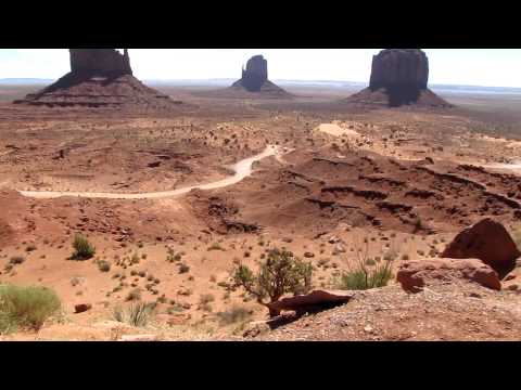
It's hard to hear any narration because it's so windy! I show the "mitten" buttes and essentially show a panorama. At 0:49 I show part of "Valley Drive," the 17-mile dirt road that leads around all the scenic buttes.

More filming of the parking lot and surroundings. It costs $5 admission to get in, and at 0:24 you see the entrance station. Worth it?

Very windy conditions on the drive from Monument Valley to Four Corners. I thought it was worth filming.

This is the view from the dirt parking lot into the monument. All in all, it wasn't all that bad, but it was $3.00 and windy. Worth it? Visiting it once, yes, but I don't know if I'd go back for a second visit.

Close-up of the cadastral survey marker and some of the states. (I took pictures of each one as well, so they don't all show up on video.)
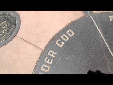
I film the middle part where the four states come together. The outer rim of the middle part reads "Four States | Meet Here | In Freedom | Under God". At the end, an upside-down view of the cadastral survey marker.

Filming the flags. I'm guessing it's the four state flags and the United States flag? No absence of breeze, that's for sure.
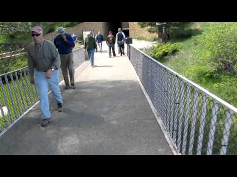
Near Cortez, CO, is Mesa Verde National Park. It focuses on preservation of ancient Pueblo cliff dwelling houses. The Anasazi inhabited this area from 600-1300 A.D.
This is the Far View Visitor's Center, and getting to it involved walking through a tunnel under State Highway 10 from the parking lot and spiraling up a walkway to get to the Visitor's Center itself. At 0:20, I film the sign. At the end of the video, I approach the tunnel.
The Far View Lodge very near here also provides accommodations.

This video shows walking through the tunnel and up the ramp towards the parking lot.

Chapin Mesa is where a lot of the "stuff" is located in Mesa Verde, and Spruce Tree House is located under a cliff overhang. It's well-preserved and you can access the front of it via a self-guided tour. There are tours of other cliff dwellings, but some are not self-guided and you have to pay extra for them in advance. I would have done so, but I didn't have time. Had to make it to South Fork!
This is Spruce Tree House from afar.

Spruce Tree House up close. Keep off walls, please.
