 RoadTrp.org | 2026 2024 2019 2018 2017 2016 2014 2013 2011 2010 2009 | parks maps trips | faq search
| RoadTrp.org | 2026 2024 2019 2018 2017 2016 2014 2013 2011 2010 2009 | parks maps trips | faq search |
| VLA/Pie Town: | [Day 1] | Tue May 10 | Drive day | Drive day · 7 videos |
| [Day 2] | Wed May 11 | The Very Large Array and Pie Town, NM; on to Grand Canyon Village | The Very Large Array and Pie Town, NM; on to Grand Canyon Village · 38 videos | |
| Grand Canyon N.P. (South Rim): | [Day 3] | Thu May 12 | Grand Canyon South Rim | Grand Canyon South Rim · 16 videos |
| [Day 4] | Fri May 13 | South Kaibab hike | South Kaibab hike · 22 videos | |
| [Day 5] | Sat May 14 | Bright Angel hike to Indian Garden | Bright Angel hike to Indian Garden · 13 videos | |
| Grand Canyon N.P. (North Rim): | [Day 6] | Sun May 15 | To the North Rim; Bright Angel Point | To the North Rim; Bright Angel Point · 27 videos |
| [Day 7] | Mon May 16 | North Rim: Walhalla Plateau | North Rim: Walhalla Plateau · 27 videos | |
| Zion N.P.: | [Day 8] | Tue May 17 | To Zion; Observation Point hike | To Zion; Observation Point hike · 19 videos |
| [Day 9] | Wed May 18 | The Narrows | The Narrows · 12 videos | |
| [Day 10] | Thu May 19 | Angels Landing and Kolob Canyons | Angels Landing and Kolob Canyons · 21 videos | |
| Great Basin N.P.: | [Day 11] | Fri May 20 | To Great Basin National Park; Lehman Caves | To Great Basin National Park; Lehman Caves · 14 videos |
| [Day 12] | Sat May 21 | Bonneville Salt Flats and Great Basin | Bonneville Salt Flats and Great Basin · 9 videos | |
| Zion N.P. (II): | [Day 13] | Sun May 22 | Second visit to Zion, then on toward Bryce Canyon | Second visit to Zion, then on toward Bryce Canyon · 25 videos |
| Bryce Canyon N.P.: | [Day 14] | Mon May 23 | Bryce Canyon National Park | Bryce Canyon National Park · 29 videos |
| Arches N.P.: | [Day 15] | Tue May 24 | To Arches via Capitol Reef | To Arches via Capitol Reef · 22 videos |
| [Day 16] | Wed May 25 | Devils Garden and Delicate Arch | Devils Garden and Delicate Arch · 14 videos | |
| [Day 17] | Thu May 26 | Fiery Furnace and Dead Horse Point | Fiery Furnace and Dead Horse Point · 8 videos | |
| Canyonlands N.P.: | [Day 18] | Fri May 27 | Canyonlands: Island in the Sky and the Needles | Canyonlands: Island in the Sky and the Needles · 22 videos |
| Monument Valley/Mesa Verde N.P.: | [Day 19] | Sat May 28 | Monument Valley and Mesa Verde | Monument Valley and Mesa Verde · 16 videos |
| Great Sand Dunes N.P.: | [Day 20] | Sun May 29 | Great Sand Dunes: Star Dune hike | Great Sand Dunes: Star Dune hike · 11 videos |
| [Day 21/22] | Mon May 30 | Great Sand Dunes backup day, then the drive east | Great Sand Dunes backup day, then the drive east · 4 videos | |
| Route Map: | [Route][all maps] | |||
| Day's Summary: Canyonlands: Island in the Sky and the Needles. Overnight: Goosenecks State Park. |

Filming the inside of the room. I had just woke up, so I sound a little slurred. (Not drunk, I promise.) I show the huge step-down at 1:35. Watch your step!

One of the few state parks I visited. You can see the bends of the Colorado River. At around 0:42 you can see some evaporation ponds used in the mining of potassium chloride, as well as a car apparently driving there. At 1:00, a 180 degree pan and view of the sky.
At 1:04 you can see the viewing platform from which I take the next video.

More breathtaking views of the Colorado River and associated landscape. Boisterous family right below the viewing platform!

Eight seconds. I think I ran out of batteries.

Lizard at 0:20. At 0:40, I zoom to Shafer Canyon Road, part of a jeep route which at that point is in Canyonlands National Park (Island in the Sky). 360 degree panorama at 0:52.
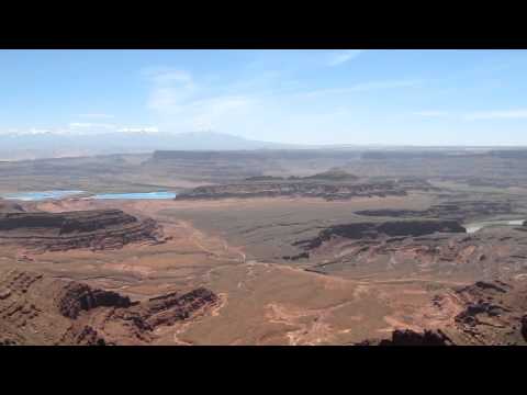
The previous videos were mostly looking south and west. This one looks towards the east and towards the evaporation pools.
Approximate location: 38.475285, -109.740600

Depending on how you divide it, there are three major land districts of Canyonlands National Park: (1) Island In the Sky, (2) Needles, and (3) Maze. According to statistics, Island gets visited by around 60% of park visitors, Needles around 35%, and Maze around 5%. (Maze is hard to access without off-road capability.) Those main 3 land districts are separated by the Green and Colorado Rivers.
There's also two other sections: the rivers themselves, and the Horseshoe Canyon Unit. Horseshoe Canyon is northwest of Maze. Remember Aron Ralston? It happened in Horseshoe Canyon. One of the most famous arches in Canyonlands, Mesa Arch is accessible via a 0.5 mile round trip hike. It's cool to see people on top of the arch.

Getting closer to the arch.

Peering through the arch. Very cool. Watch your step.

Nearby Mesa Arch, giving a view towards the Needles District. You can see a guy standing on top of Mesa Arch. I never got the guts to stand on top of it.
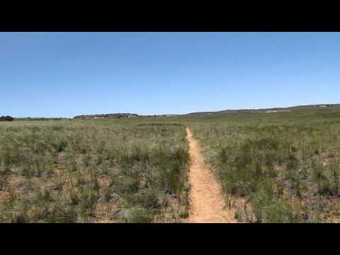
Even though I saw into the canyon from Mesa Arch, this would have been a fantastic hike through Gray's Meadow along the Lathrop Trail. I didn't have time or I would have hiked it. 360 degree pan at 1:15.

Time was limited, and while I would have loved to go to Needles, I thought that it would have taken too long and I might not get enough out of it. Instead, I opted for the Needles Overlook, which is part of the Bureau of Land Management's Canyon Rims Recreation Area.
This is Sixshooter Viewpoint, a name derived from lightning hitting pistol-like spires (which would be "firing" the pistol). Very beautiful, and the video does not at all capture the grandiosity of this scene. I explain that driving to the Needles Overlook was less time/distance than driving to the Needles District itself.

Showing the fence holding people back from getting to the very edge.

A chainlink fence and a magnificent, breathtaking view.

Going for a walk alongside the fence. Notice the butte coming into view from behind the greenery at around 1:00. That's Junction Butte, which is part of the Island In The Sky District. To the right of it (which would be north of it) is the main Island In The Sky Mesa, which includes Grand View Point.
The views here are magnificent, surreal, and almost otherworldly, don't you think? Almost a "utopian" view.

The road I zoom in on is Lock Hart Road, a road actually east of Canyonlands National Park. What's funny about a lot of these views from Needles Overlook is that while they're extremely scenic and representative of the terrain, they're not technically inside the Needles District.
The flat terrain to the right (west) of Lock Hart Road is adjacent to the Needles District. I don't really have the zoom to see a lot of the intricate features of the Needles District.

A lizard hanging out, ostensibly enjoying the scenery?

Great views, 360 degree panorama.

A view of the Colorado River, towards Island In The Sky and Dead Horse Point.

Ah, one of my favorite places on the road trip. Part of the reason is it's cheap (zero dollars). Part of the reason is it's undiscovered. It's Goosenecks State Park, and it's really close to Monument Valley There aren't any marked campsites, and there are no facilities other than a pit toilet, so don't come here for luxurious accommodations.

A view of the "goosenecks" of the San Juan River.
I counted probably 7-8 groups of people camping here, and even so you can spread out a great deal. You can stay on the western part of the park where the pit toilet is (as you enter). Or, if you turn left (east) as you're entering the Park, there's a (dirt) road that goes pretty far and down a thin leg of land that projects into a bend of the San Juan River.

Here, I'm in the west part of the parking area. Initially I film north towards the toilet building and the entrance road, and then at 0:05 I pan towards the eastern part where you can see my blue rental RAV4 (to the left) amongst other vehicles. I then pan south to show more of the western part of the parking area.
The sky was unbelievably clear the night I stayed, and was a sight to behold. Aside from seeing thousands upon thousands of stars, I saw the central plane of stars in the Milky Way galaxy. "Earthshine" allowed me to see the dark park of the crescent moon. I saw lights of airplanes in the far, far distance.
Suffice it to say, this is a good place to be if you like stargazing/astronomy. There are few places in the country with very, very dark skies, and this must be one of the best.