 RoadTrp.org | 2026 2024 2019 2018 2017 2016 2014 2013 2011 2010 2009 | parks maps trips | faq search
| RoadTrp.org | 2026 2024 2019 2018 2017 2016 2014 2013 2011 2010 2009 | parks maps trips | faq search |
| Travel: | [Day 0] | Fri May 22 | Drive day · no videos | Drive day · no videos |
| Grand Canyon N.P.: | [Day 1] | Sat May 23 | First day at the Grand Canyon South Rim | First day at the Grand Canyon South Rim · 6 videos |
| [Day 2] | Sun May 24 | Grand Canyon South Rim | Grand Canyon South Rim · 15 videos | |
| Hoover Dam/Las Vegas: | [Day 3] | Mon May 25 | Hoover Dam, then on to Las Vegas | Hoover Dam, then on to Las Vegas · 5 videos |
| [Day 4] | Tue May 26 | Las Vegas | Las Vegas · 5 videos | |
| Yellowstone N.P.: | [Day 5] | Wed May 27 | En route to Yellowstone | En route to Yellowstone · 7 videos |
| [Day 6] | Thu May 28 | Yellowstone National Park | Yellowstone National Park · 42 videos | |
| Yellowstone/Grand Teton N.P.: | [Day 7] | Fri May 29 | Yellowstone and Grand Teton National Parks, then the start of the straight-through drive home | Yellowstone and Grand Teton National Parks, then the start of the straight-through drive home · 29 videos |
| Drive Home: | [Day 8/9] | Sat May 30/31 | Drove straight home from Grand Teton with no overnight stop, arriving early Sunday morning | Drove straight home from Grand Teton with no overnight stop, arriving early Sunday morning · 1 video |
| Route Map: | [Route][all maps] | |||
| Day's Summary: Yellowstone and Grand Teton National Parks, then the start of the straight-through drive home. |

Approximate Location: 44.946439, -110.648956

Similar video to the previous one.

Woo!

Yeah! Yellowstone!
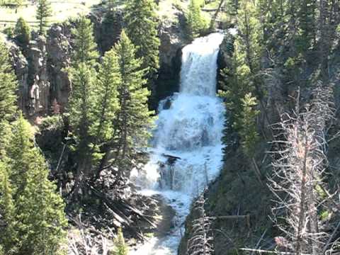
Near Mammoth Hot Springs, on the northern part of Grand Loop Road.

This was along a pullout approximately 4 miles east of Mammoth Hot Springs.

Approximate Location: 44.940778, -110.632676

Passing the bison on a bridge. It's amazing how ostensibly unafraid bison are of this type of human activity.

Not sure if this is a black bear or a grizzly, but it looks like a black bear. I can't determine exactly where I took this, as I provided no context clues. I'm pretty sure it's between Lava Creek and Floating Island Lake, at around the coordinates 44.952234, -110.478641. I don't provide a link because I'm not sure of them!

Drove a bit along the NE Entrance Road (leads to Beartooth Highway) and doubled back.
Approximate Location: 44.919578, -110.303195

Some deer near Lamar Valley (along the NE Entrance Road)

Somewhere near Tower Junction.

Great view of the Yellowstone River near Tower Junction & Calcite Springs.

More of the Yellowstone River.
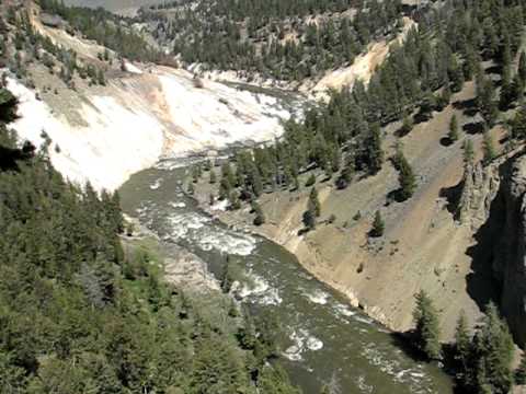
The Yellowstone River bifurcates to give off the Lamar River just north of here (near Tower Junction). Soon thereafter, the Lamar River bifurcates to give off Slough Creek.

Very windy. Great short hike to a small hill overlooking the area.
Approximate Location: 44.816667, -110.450278

These falls are twice as high as Niagara Falls, at around 300 feet. You can hike to the brink of the falls using the Brink of the Lower Falls Trail. As the sign will indicate, it's only a 3/8 mile hike but it's a 600 foot drop! At around 12 seconds, I pan to the lowest observation location of the falls, which is bigger. I'm at the smaller one that's slightly up the trail. The next video is from the lowest observation location.

This is from the lowest observation location, and shows all that water spilling over (as well as a rainbow.) At its peak, the volume of water going over these falls can be above 60,000 gallons a second.

I did some research on the USGS' website on the Yellowstone Lake Outlet measurement for 2009, and at least at that location (which is not here but upstream) the flow was around 20,000 gallons per second for this day. Peak for 2009 was around July 4th or so at 50,000 gallons.
So, I'm not sure how much more water is added to the Yellowstone River from the Lake Outlet to the Lower Falls, but I'm sure those numbers are increased.

Great view of Lower Falls from Lookout Point.

Quite a "grand view," eh?
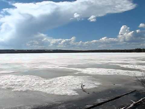
This is Lewis Lake, not Heart Lake. Heart Lake isn't visible from the road.
Approximate Location: 44.309727, -110.602214

Approximate Location: 44.219883, -110.656256

Similar location to the last video.
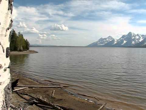
Near the Lizard Creek Campground, roughly east of it.
Approximate location: 44.000396, -110.677632

Great view of Mount Moran from here.
Approximate location: 43.806821, -110.628398

I always think of Forrest Gump when this lake is mentioned. Beautiful view, too.
Approximate location: 43.767846, -110.717403

You can get a good view of my rental vehicle. This is near Moose Junction where the two southern "prongs" of the park split. Jackson, WY is directly south on US-89.
Approximate location: 43.633517, -110.717233

Lots of cattle. Large ranch. Very cool.
Approximate location: 42.9742500, -110.0903667