 RoadTrp.org | 2026 2024 2019 2018 2017 2016 2014 2013 2011 2010 2009 | parks maps trips | faq search
| RoadTrp.org | 2026 2024 2019 2018 2017 2016 2014 2013 2011 2010 2009 | parks maps trips | faq search |
| To Staunton, VA: | [Day 1] | Sun Mar 7 | To Staunton, VA | To Staunton, VA · 8 videos |
| BRP (Peaks of Otter): | [Day 2] | Mon Mar 8 | BRP (Peaks of Otter) | BRP (Peaks of Otter) · 21 videos |
| BRP (Boone, NC): | [Day 3] | Tue Mar 9 | BRP (Boone, NC) | BRP (Boone, NC) · 14 videos |
| Blue Ridge Parkway: | [Day 4] | Wed Mar 10 | Blue Ridge Parkway | Blue Ridge Parkway · 15 videos |
| Route Map: | [Route][all maps] | |||

Driving around and missing my turn! Birthplace of President Woodrow Wilson.

Exit 99, Rockfish Gap. End of Skyline Drive and the beginning of the Blue Ridge Parkway. Mile 1!

But it's closed.

Taking US-151 South (Rockfish Valley Highway), trying to find an entrance point. Nellysford area.

Route 664 (Beech Grove Road), trying to intersect with the Blue Ridge Parkway at mile marker 13-14.
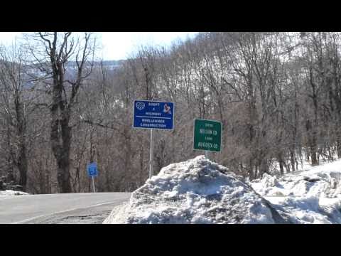
Is the BRP closed here? It's plowed. This is the Reid's Gap entrance mile (marker 13-14) where Route 664 meets the Parkway.

Is the BRP closed here? There wasn't a gate restricting entrance!
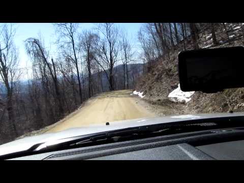
Campbell's Mountain Road. I believe this road was paved around 2019, so 9 years or so after this video. Major hairpin turn at 5:50 or so.

Love Gap, mile marker 16.

Near Humphreys Gap, around mile marker 45.

Reid Hollow Road goes under the Parkway, I think I took perhaps Panther Gap from the Humphreys Gap closure to this underpass?

Taking Reid Hollow Road to connect to US-60 near Buena Vista, VA.

Getting to the end of Reid Hollow Road to join US-60 near Buena Vista, VA.

First (very short) video taken with the Canon PowerShot SD1200IS (480p 30fps). Has a different aspect ratio than the Canon SX20IS (720p 30fps).
Intersection of US-501 and W 21st street.

The parkway was closed or mostly closed from 0-60. Slightly north of Otter Creek.

At the turnaround point. I ended up not getting to the summit because of the dangerous snowy, slippery conditions. And I was wearing hiking boots, too. Selfie!

Another view of the turnaround point with the other camera.

Turned around before getting to the summit. Too slippery. Too dangerous.

Good overview of the Peaks of Otter and Sharp Top. Snowy lodge, but it was open (unlike a lot of the parkway)!

Abbott Lake is the lake adjacent to the lodge. Very serene and a good place to stay near the Blue Ridge Parkway. Frozen lake, a sunset, a deer, a bird, and Sharp Top!

I can't see anything, and why don't I TALK LOUDER? Darkness!