 RoadTrp.org | 2026 2024 2019 2018 2017 2016 2014 2013 2011 2010 2009 | parks maps trips hikes | faq search
| RoadTrp.org | 2026 2024 2019 2018 2017 2016 2014 2013 2011 2010 2009 | parks maps trips hikes | faq search |
| Day's Summary: Drone footage (DJI Mini 2 SE) at the "top" of the Cherohala Skyway. Big Junction Overlook, Santeetlah Overlook, and Hooper Bald are in close proximity to one another. |
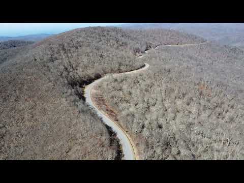
It's not really signed, so it helps to know your approximate location and altitude. 5235 feet.

Started the video after launch. Just considering the road itself, this is the "top" of the Skyway at 5390 feet.
This shouldn't be confused with the "Santeetlah Gap Overlook" which is nearer to the North Carolina terminus of the Skyway.

There's a short hiking trail over to Hooper Bald. 5290 feet at the trailhead, and 5429 feet at the bald itself.
FYI, Huckleberry Knob is at 5560 feet, and that's the highest point of the land adjacent to the Skyway.
Map © OpenStreetMap © CARTO.